Case study:Restoration of Ingarskilanjoki River: Difference between revisions
No edit summary |
No edit summary |
||
| (11 intermediate revisions by 5 users not shown) | |||
| Line 1: | Line 1: | ||
{{ | {{Case study status | ||
|Approval status= | |Approval status=Approved | ||
}} | }} | ||
{{Location | {{Location | ||
| Line 17: | Line 12: | ||
|Main contact surname=Aulaskari | |Main contact surname=Aulaskari | ||
|Contact organisation=Centre for Economic Development, Transport and the Environment for Uusimaa | |Contact organisation=Centre for Economic Development, Transport and the Environment for Uusimaa | ||
|Multi-site=Yes | |Multi-site=Yes | ||
|Project picture=Knutsinvirta ingarskilanjoki (photo.Harri Aulaskari).jpg | |Project picture=Knutsinvirta ingarskilanjoki (photo.Harri Aulaskari).jpg | ||
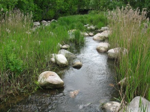
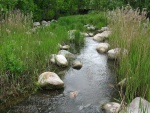
|Picture description= | |Picture description=Restored Knutsinvirta (photo: Harri Aulaskari) | ||
|Project summary=The Ingarskilanjoki River is 50 km long and runs into the Gulf of Finland. The Ingarskilanjoki River is the only river in Finland where the population of extremely endangered migrating sea trout (Salmo trutta) is natural, not from stocking. Due to flooding of the fields the river was straightened and dredged in 1988. The river was restored in 2002-2007 to recreate habitats for trout and its reproduction for the whole river length. The goal of the restoration was | |Project summary=The Ingarskilanjoki River is 50 km long and runs into the Gulf of Finland. The Ingarskilanjoki River is the only river in Finland where the population of extremely endangered migrating sea trout (Salmo trutta) is natural, not from stocking. Due to flooding of the fields the river was straightened and dredged in 1988. The river was restored in 2002-2007 to recreate habitats for trout and its reproduction for the whole river length. The goal of the restoration was to increase the morphological diversity of the river by e.g. creating more variation of depths and meanders and adding gravel for fish spawning. The goal was also to enable the trout to migrate between the river and sea. In addition buffer strips were created to the catchment to decrease the nutrient loading from arable areas and to decrease turbidity of the river water. The local land owners and river side inhabitants were interviewed in order to take into account their opinions due to restoration. To ensure the recovery of the natural sea trout population, the trout fishing was prohibited in the river after the restoration. Before the dredging of the river, natural trout were caught and raised for further farming. After the dredging, the trouts that were caught from the natural population were stocked back into the river. However, because of the clearing and lost habitats, the reproduction of the trout had been weakened. The key success factor was that the decision of the preservation was made by the local fishing society. This is most likely the reason for that the fishing restriction has been obeyed which again has been crucial for balancing the reproduction and population of the sea trout. Since strict fishing restrictions, restorations and additional fish stockings, the local trout population has grown. These results shows that the restoration as a whole was succeeded. | ||
}} | |||
{{Image gallery}} | |||
{{Case study image | |||
|File name=Before restauration(photo.Harri Aulaskari)300.jpg | |||
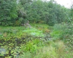
|Caption=Ingarskilanjoki River before restoration (photo: Harri Aulaskari) | |||
}} | }} | ||
{{Case study image | |||
|File name=Knutsinvirta ingarskilanjoki (photo.Harri Aulaskari).jpg | |||
|Caption=Knutsinvirta after restoration (photo: Harri Aulaskari) | |||
}} | |||
{{Image_gallery_end}} | |||
{{Toggle button}} | |||
{{Toggle content start}} | |||
{{Case_study_subcatchment | {{Case_study_subcatchment | ||
|Subcatchment= | |Subcatchment= | ||
| Line 166: | Line 172: | ||
}} | }} | ||
{{Measures | {{Measures | ||
|Bank and bed modifications measure= | |Bank and bed modifications measure=Depth variation,Re-introducing stones, Introduction of gravel, Creation of fish passes, | ||
|Floodplain / River corridor=Buffer strips | |||
|Wider stakeholder / citizen engagement=Participation in design,Information provision | |||
|Floodplain / River corridor= | |||
|Wider stakeholder / citizen engagement= | |||
}} | }} | ||
{{Hydromorphological_quality_elements_header}} | {{Hydromorphological_quality_elements_header}} | ||
| Line 272: | Line 265: | ||
{{Monitoring_documents}} | {{Monitoring_documents}} | ||
{{Monitoring_documents_end}} | {{Monitoring_documents_end}} | ||
{{Additional_Documents}} | {{Additional_Documents}} | ||
{{Additional_Documents_end}} | {{Additional_Documents_end}} | ||
| Line 302: | Line 285: | ||
}} | }} | ||
{{Case_study_upload}} | {{Case_study_upload}} | ||
{{Toggle content end}} | |||
Latest revision as of 08:35, 2 June 2017
Project overview
| Status | Complete |
|---|---|
| Project web site | |
| Themes | Habitat and biodiversity |
| Country | Finland |
| Main contact forename | Harri |
| Main contact surname | Aulaskari |
| Main contact user ID | |
| Contact organisation | Centre for Economic Development, Transport and the Environment for Uusimaa |
| Contact organisation web site | |
| Partner organisations | |
| This is a parent project encompassing the following projects |
Project summary
The Ingarskilanjoki River is 50 km long and runs into the Gulf of Finland. The Ingarskilanjoki River is the only river in Finland where the population of extremely endangered migrating sea trout (Salmo trutta) is natural, not from stocking. Due to flooding of the fields the river was straightened and dredged in 1988. The river was restored in 2002-2007 to recreate habitats for trout and its reproduction for the whole river length. The goal of the restoration was to increase the morphological diversity of the river by e.g. creating more variation of depths and meanders and adding gravel for fish spawning. The goal was also to enable the trout to migrate between the river and sea. In addition buffer strips were created to the catchment to decrease the nutrient loading from arable areas and to decrease turbidity of the river water. The local land owners and river side inhabitants were interviewed in order to take into account their opinions due to restoration. To ensure the recovery of the natural sea trout population, the trout fishing was prohibited in the river after the restoration. Before the dredging of the river, natural trout were caught and raised for further farming. After the dredging, the trouts that were caught from the natural population were stocked back into the river. However, because of the clearing and lost habitats, the reproduction of the trout had been weakened. The key success factor was that the decision of the preservation was made by the local fishing society. This is most likely the reason for that the fishing restriction has been obeyed which again has been crucial for balancing the reproduction and population of the sea trout. Since strict fishing restrictions, restorations and additional fish stockings, the local trout population has grown. These results shows that the restoration as a whole was succeeded.
Monitoring surveys and results
Lessons learnt
Image gallery
|
Catchment and subcatchmentSelect a catchment/subcatchment
Catchment
Subcatchment
Site
Project background
Cost for project phases
Reasons for river restoration
Measures
MonitoringHydromorphological quality elements
Biological quality elements
Physico-chemical quality elements
Any other monitoring, e.g. social, economic
Monitoring documents
Additional documents and videos
Additional links and references
Supplementary InformationEdit Supplementary Information
| ||||||||||||||||||||||||||||||||||||||||||||||||||||||||||||||||||||||||||||||||||||||||||||||||||||||||||||||||||||||||||||||||||||||||||||||||||||||||||||||||||||||||||||||||||||||||||||||||||||||||||||||||||||||||||


