Case study:ReNaturalize: Difference between revisions
No edit summary |
No edit summary |
||
| Line 47: | Line 47: | ||
{{Case study image | {{Case study image | ||
|File name=RENATURALIZE 2015-08-17 10-37-19 edit reduzida.jpg | |File name=RENATURALIZE 2015-08-17 10-37-19 edit reduzida.jpg | ||
|Caption= | |Caption=Steel cable anchor | ||
}} | }} | ||
{{Image gallery end}} | {{Image gallery end}} | ||
Revision as of 15:02, 10 September 2015
This case study is pending approval by a RiverWiki administrator.
Project overview
| Status | In progress |
|---|---|
| Project web site | http://http://www.aplysia.com.br/renaturalize/ |
| Themes | Environmental flows and water resources, Fisheries, Habitat and biodiversity, Hydromorphology, Monitoring, Social benefits, Water quality |
| Country | Brazil |
| Main contact forename | Carolina |
| Main contact surname | Pinto |
| Main contact user ID | User:Carolfp10 |
| Contact organisation | Aplysia |
| Contact organisation web site | http://www.aplysia.com.br/site/en/ |
| Partner organisations | FAPES, FINEP |
| Parent multi-site project | |
| This is a parent project encompassing the following projects |
No |
Project summary
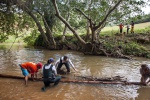
The project ReNaturalize consists on the installation of large wood (LWD) in the River Mangaraí, ES-Brazil. It is an innovative initiative of Aplysia Environmental Solutions. In this project a British technique of river restoration was used where tree trunks are installed on the riverbed as a form of river restoration.
The aim is to restore natural river processes that can support healthier and more biodiverse aquatic environments.
In other words, the project aims to restore the natural function of the river, that happens when riparian vegetation grows wirth trees and branches falling naturally in the river, creating healthier environments in a sustainable manner.
We also seek the integration with local communities. To integrate the community's goals with the project objectives aligning interests.
The installations included techniques listed below: - 'D' structures; - Flexible anchoring large wood; - Rigid anchoring; - 'Staking';
Monitoring surveys and results
Monitoring for the project is in progress.
The aim is to have intensive monitoring as to understand the effectiveness of wood in a tropical environment including: water quality, sediment quality, aquatic biota (fish and macroinvertebrates), hydrology, hydromorfology and public perception during the 2 years of the project. Results will be shared once the restoration project is completed.
Lessons learnt
Image gallery
|
Catchment and subcatchmentSelect a catchment/subcatchment
Catchment
Subcatchment
Site
Project background
Cost for project phases
Reasons for river restoration
Measures
MonitoringHydromorphological quality elements
Biological quality elements
Physico-chemical quality elements
Any other monitoring, e.g. social, economic
Monitoring documents
Additional documents and videos
Additional links and references
Supplementary InformationEdit Supplementary Information
| ||||||||||||||||||||||||||||||||||||||||||||||||||||||||||||||||||||||||||||||||||||||||||||||||||||||||||||||||||||||||||||||||||||||||||||||||||||||||||||||||||||||||||||||||||||||||||||||||||||||||


