File:Voorste Nete, Dessels pre post.png: Difference between revisions
Jump to navigation
Jump to search
(Upper row (left and right): original reach of the Voorste Nete. Middle row (left and right): Excavation of a 5 m wide stretch for placing the bentonite mat and refilling with the original sand. Bottom row (left and right): Diverted reach of the Voorste ) |
(No difference)
|
Latest revision as of 11:08, 30 August 2012
Upper row (left and right): original reach of the Voorste Nete. Middle row (left and right): Excavation of a 5 m wide stretch for placing the bentonite mat and refilling with the original sand. Bottom row (left and right): Diverted reach of the Voorste Nete, dug out in sand filled bentonite lining with transferred substrate from the original reach, and the same stretch 6 months later during first monitoring showing the changes in dimensions caused by a summer storm in 2004.
File history
Click on a date/time to view the file as it appeared at that time.
| Date/Time | Thumbnail | Dimensions | User | Comment | |
|---|---|---|---|---|---|
| current | 11:08, 30 August 2012 | 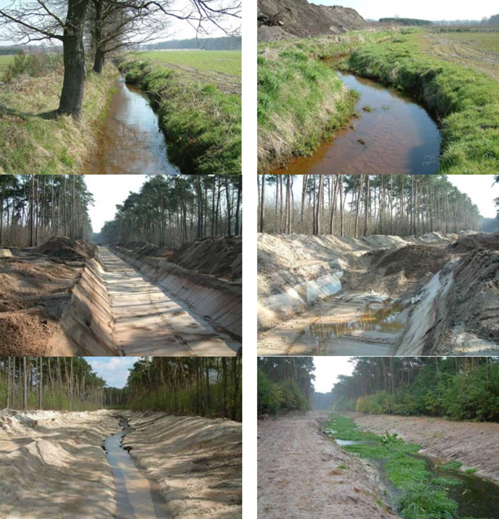 | 1,012 × 1,052 (2.7 MB) | NickRRC (talk | contribs) | Upper row (left and right): original reach of the Voorste Nete. Middle row (left and right): Excavation of a 5 m wide stretch for placing the bentonite mat and refilling with the original sand. Bottom row (left and right): Diverted reach of the Voorste |
You cannot overwrite this file.
File usage
The following page uses this file: