Case study:Diversion of the River Nith: Difference between revisions
No edit summary |
No edit summary |
||
| Line 37: | Line 37: | ||
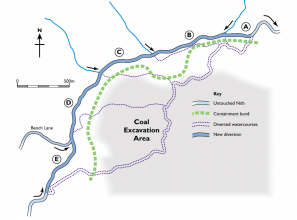
PHASE 2: During 2004, the former course was enhanced and reconnected to the rest of the river and the temporary channel cut off to allow mining to progress across the floodplain. The site was subject to significant post-restoration biological monitoring as part of a PhD programme through CRESS (Centre for River Ecosystem Science - University of Stirling) - to ensure the new channel was performing well, ecologically. | PHASE 2: During 2004, the former course was enhanced and reconnected to the rest of the river and the temporary channel cut off to allow mining to progress across the floodplain. The site was subject to significant post-restoration biological monitoring as part of a PhD programme through CRESS (Centre for River Ecosystem Science - University of Stirling) - to ensure the new channel was performing well, ecologically. | ||
}} | }} | ||
{{Image gallery}} | |||
{{Case study image | |||
|File name=300mldsjul2000.jpg | |||
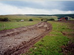
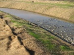
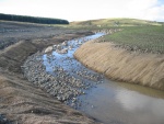
|Caption=Channel diversion in construction (2000). Courtesy of the River Restoration Centre. | |||
}} | |||
{{Case study image | |||
|File name=300mldsnov2000.jpg | |||
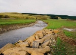
|Caption=Diverted channel once connected (2000). Courtesy of the River Restoration Centre. | |||
}} | |||
{{Case study image | |||
|File name=Nith23a.jpg | |||
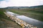
|Caption=Diversion channel prior to connection - rip-rap and riffle visible (2000). Courtesy of the River Restoration Centre. | |||
}} | |||
{{Case study image | |||
|File name=Img 2986.jpg | |||
|Caption=Diversion channel (2004) showing geotextile bank reinforcement and profiled gravel bed for habitat enhancement. Courtesy of the River Restoration Centre. | |||
}} | |||
{{Case study image | |||
|File name=Img 2990.jpg | |||
|Caption=Diversion channel (2004) showing geotextile bank reinforcement, profiled gravel bed and in-channel boulder placement for habitat enhancement. Courtesy of the River Restoration Centre. | |||
}} | |||
{{Image gallery end}} | |||
{{Toggle button}} | |||
{{Toggle content start}} | |||
{{Case study subcatchment | {{Case study subcatchment | ||
|Subcatchment=Nith | |Subcatchment=Nith | ||
| Line 118: | Line 142: | ||
{{Monitoring documents}} | {{Monitoring documents}} | ||
{{Monitoring documents end}} | {{Monitoring documents end}} | ||
{{Additional Documents}} | {{Additional Documents}} | ||
{{Additional Documents end}} | {{Additional Documents end}} | ||
| Line 157: | Line 159: | ||
{{Additional links and references footer}} | {{Additional links and references footer}} | ||
{{Supplementary Information}} | {{Supplementary Information}} | ||
{{Toggle content end}} | |||
Revision as of 08:57, 6 September 2013
Project overview
| Status | Complete |
|---|---|
| Project web site | |
| Themes | Economic aspects, Habitat and biodiversity |
| Country | Scotland |
| Main contact forename | Nick |
| Main contact surname | Elbourne |
| Main contact user ID | User:NickRRC |
| Contact organisation | River Restoration Centre |
| Contact organisation web site | |
| Partner organisations | East Ayrshire Council, SEPA, SNH, RSPB, Nith Salmon Fisheries Board, New Cumnock Angling Association, Halcrow, River Restoration Centre |
| Parent multi-site project | |
| This is a parent project encompassing the following projects |
No |
Project summary
PHASE 1: 2000 - Temporary diversion of the Nith to the north west of its current floodplain to allow for coal extraction by Scottish Coal.
The Nith is an important salmon and trout fishery, however overgrazing, agriculture and past open-cast mining along the reach have affected invertebrate populations and fish spawning grounds.
The primary restoration criteria for the 2000 restoration were:
- design which would convey a 1 in 50 year flood.
- channel which would not dry up during low flow.
- design mimicing pre-diversion channel - ie. similar meander loops, pool-riffle-run sequences and channel profiles.
- design which would create opportunities for enhancement of biodiversity (over and above pre-diversion conditions).
Work commenced in April 2000 and was completed during September of the same year.
PHASE 2: During 2004, the former course was enhanced and reconnected to the rest of the river and the temporary channel cut off to allow mining to progress across the floodplain. The site was subject to significant post-restoration biological monitoring as part of a PhD programme through CRESS (Centre for River Ecosystem Science - University of Stirling) - to ensure the new channel was performing well, ecologically.
Monitoring surveys and results
Lessons learnt
Image gallery
|
Catchment and subcatchmentSelect a catchment/subcatchment
Catchment
Subcatchment
Site
Project background
Cost for project phases
Reasons for river restoration
Measures
MonitoringHydromorphological quality elements
Biological quality elements
Physico-chemical quality elements
Any other monitoring, e.g. social, economic
Monitoring documents
Additional documents and videos
Additional links and references
Supplementary InformationEdit Supplementary Information
| ||||||||||||||||||||||||||||||||||||||||||||||||||||||||||||||||||||||||||||||||||||||||||||||||||||||||||||||||||||||||||||||||||||||||||||||||||||||||||||||||||||||||||||||||||||||||||||||||||||||||||||||||||||||||||||||||


