Case study:Braid Burn at Inch Park: Difference between revisions
No edit summary |
No edit summary |
||
| Line 22: | Line 22: | ||
Environmental improvements included lowering artificially raised banks and the concrete channel was replaced with sinuous meanders to restore the watercourse. Wetland areas were created to provide habitat variety. | Environmental improvements included lowering artificially raised banks and the concrete channel was replaced with sinuous meanders to restore the watercourse. Wetland areas were created to provide habitat variety. | ||
}} | }} | ||
{{Image gallery}} | |||
{{Case study image | |||
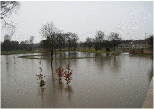
|File name=April 2006 Pre works.JPG | |||
|Caption=Before works - April 2006 | |||
}} | |||
{{Case study image | |||
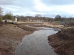
|File name=Jan 2009 Opening meanders.JPG | |||
|Caption=Opening new meanders - Jan 2009 | |||
}} | |||
{{Case study image | |||
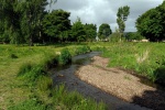
|File name=Feb 2009 Complete.JPG | |||
|Caption=Completed channel - Feb 2009 | |||
}} | |||
{{Case study image | |||
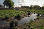
|File name=May 2011 Main channel.JPG | |||
|Caption=Two years post restoration - May 2011 | |||
}} | |||
{{Case study image | |||
|File name=LoRres89.JPG | |||
|Caption=Wetland area - May 2011 | |||
}} | |||
{{Case study image | |||
|File name=100 1042.jpg | |||
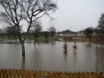
|Caption=Wetland area in flood - March 2010 | |||
}} | |||
{{Image gallery end}} | |||
{{Toggle button}} | |||
{{Toggle content start}} | |||
{{Case study subcatchment | {{Case study subcatchment | ||
|Subcatchment=Braid Burn | |Subcatchment=Braid Burn | ||
| Line 66: | Line 94: | ||
{{Monitoring documents}} | {{Monitoring documents}} | ||
{{Monitoring documents end}} | {{Monitoring documents end}} | ||
{{Additional Documents}} | {{Additional Documents}} | ||
{{Additional Documents end}} | {{Additional Documents end}} | ||
| Line 101: | Line 103: | ||
{{Additional links and references footer}} | {{Additional links and references footer}} | ||
{{Supplementary Information}} | {{Supplementary Information}} | ||
{{Toggle content end}} | |||
Revision as of 07:15, 6 September 2013
Project overview
| Status | Complete |
|---|---|
| Project web site | |
| Themes | Flood risk management, Habitat and biodiversity |
| Country | Scotland |
| Main contact forename | Nick |
| Main contact surname | Elbourne |
| Main contact user ID | |
| Contact organisation | River Restoration Centre |
| Contact organisation web site | http://www.therrc.co.uk |
| Partner organisations | |
| Parent multi-site project | |
| This is a parent project encompassing the following projects |
No |
Project summary
The artificial burn corridor had little character, with very poor habitat possessing low diversity in species. The restoration project was implemented to improve the environment on the burn corridor and reduce the risk of flooding (to a 1 in 200 year event). During a 2010 flood event the project proved to successfully limit flood waters to designated flood areas.
The works comprised a two stage flood defence scheme with the first stage being a low bund to withhold a 1 in 20 year event. The second stage works involved the construction of clay embankments and sheet pile and concrete walls clad in stone recovered from the park’s boundary wall creating 190,000m³ of flood reservoir storage.
Environmental improvements included lowering artificially raised banks and the concrete channel was replaced with sinuous meanders to restore the watercourse. Wetland areas were created to provide habitat variety.
Monitoring surveys and results
Lessons learnt
Image gallery
|
Catchment and subcatchmentSelect a catchment/subcatchment
Catchment
Subcatchment
Site
Project background
Cost for project phases
Reasons for river restoration
Measures
MonitoringHydromorphological quality elements
Biological quality elements
Physico-chemical quality elements
Any other monitoring, e.g. social, economic
Monitoring documents
Additional documents and videos
Additional links and references
Supplementary InformationEdit Supplementary Information
| ||||||||||||||||||||||||||||||||||||||||||||||||||||||||||||||||||||||||||||||||||||||||||||||||||||||||||||||||||||||||||||||||||||||||||||||||||||||||||||||||||||||||||||||||||||||||||||||||||||||||||

